Dig deeper: revealing the ruins of Brunell Township
The low stone walls and earthen banks of a post-medieval township were recently discovered in Glen Brittle Forest on the Isle of Skye during an environmental check ahead of harvesting.
Likely dating from the 17th and 18th centuries, the township comprises a range of houses, byres, barns and corn-drying kilns. The buildings were located within a mature conifer plantation of predominantly Sitka spruce that was planted in 1977, with many sites partially masked by windblown trees.
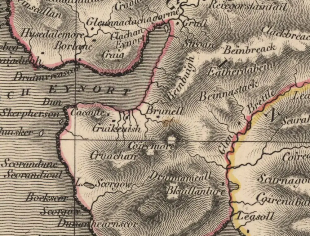
We recently commissioned a detailed survey by AOC Archaeology. Before their fieldwork, the archaeologists first looked at the historic records. They discovered that the township is referred to as Brunell on an early 19th century map (pictured above), surveyed by John Thomson in 1832. Then they consulted the Old and New Statistical Accounts for the Parish of Bracadale on Skye. There was no specific information about the township itself, but there were general descriptions of life in the parish:
“the parish produces black cattle, sheep and horses. Black cattle is the main staple... from the returns of which the people pay their rents and supply themselves with necessities. There are small quantities of sheep on each farm, but there is no farm laid out entirely to sheep pasture” (Bracadale, County of Inverness, OSA, Vol. 22, 1792).
Almost 50 years later, the minister reported that “at the time of the last [Old] Statistical Account, the population was 2250 souls. By the last census it was 1769, and since that period there has been a farther decrease. This decrease is solely to be ascribed to the system of farming which has for some time been adopted: throwing a number of farms into one large tack for sheep-grazing, and dispossessing and setting adrift the small tenants” (Bracadale, County of Inverness, NSA, Vol. 14, 1840). This was the fate that lay in store for the inhabitants of Brunell. The township was deserted by the time of the first Ordnance Survey, who depict only two unroofed buildings and a field on their map from 1881.
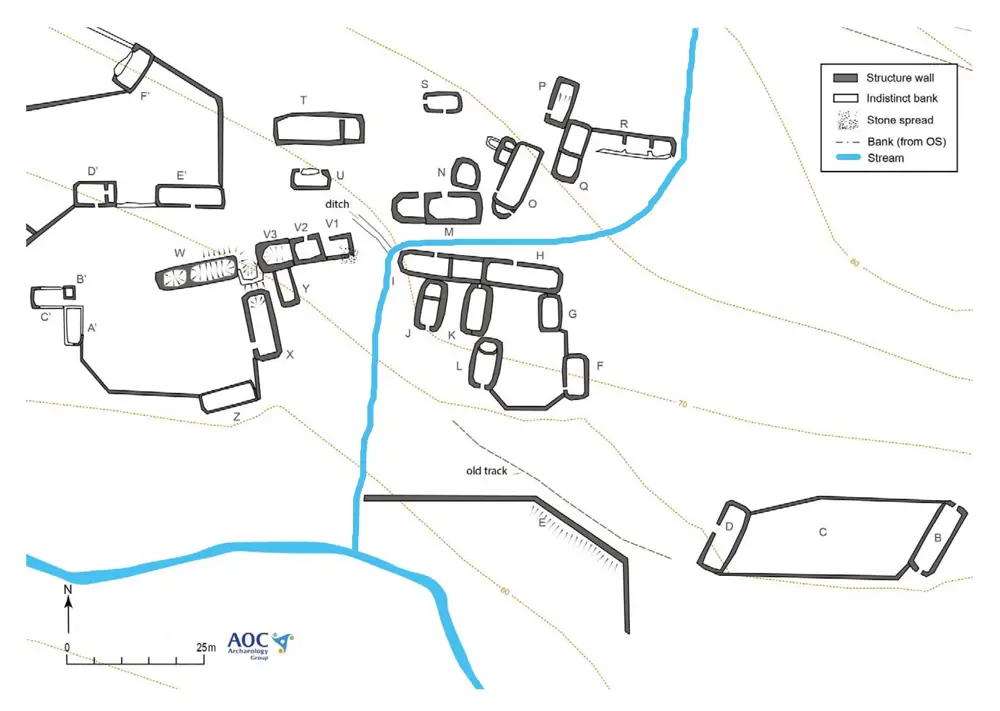
Twenty-eight buildings were recorded by the archaeological survey, clustered together with fields and stock enclosures to form a small clachan (or township), set on terraces on the N side of the Allt Dabhoch burn.
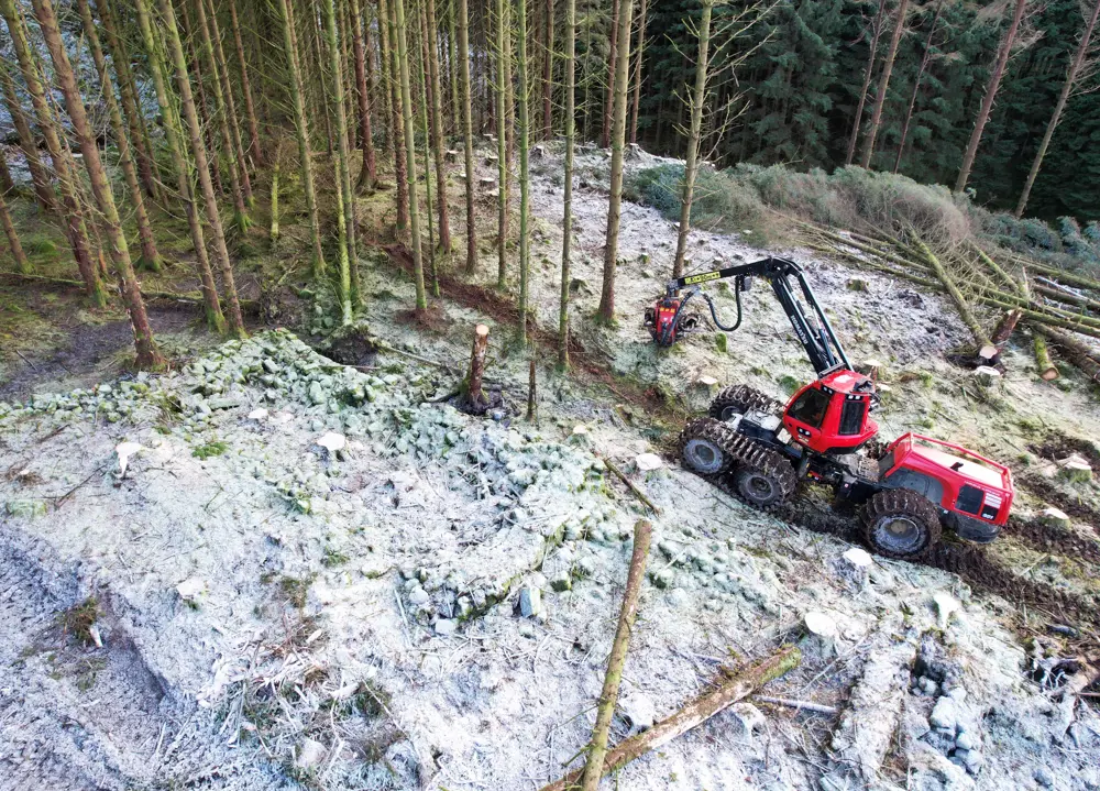
The archaeological survey was then used to inform the careful planning and delivery of a clear fell operation by Highland Timber Harvesting on behalf of Tilhill. The individual buildings were first marked out on the ground. The machine operators then used their skill and experience to carefully plan the harvesting operation, using short tracks to work their way around the township and felling trees into open space, away from the buildings to avoid causing any damage.
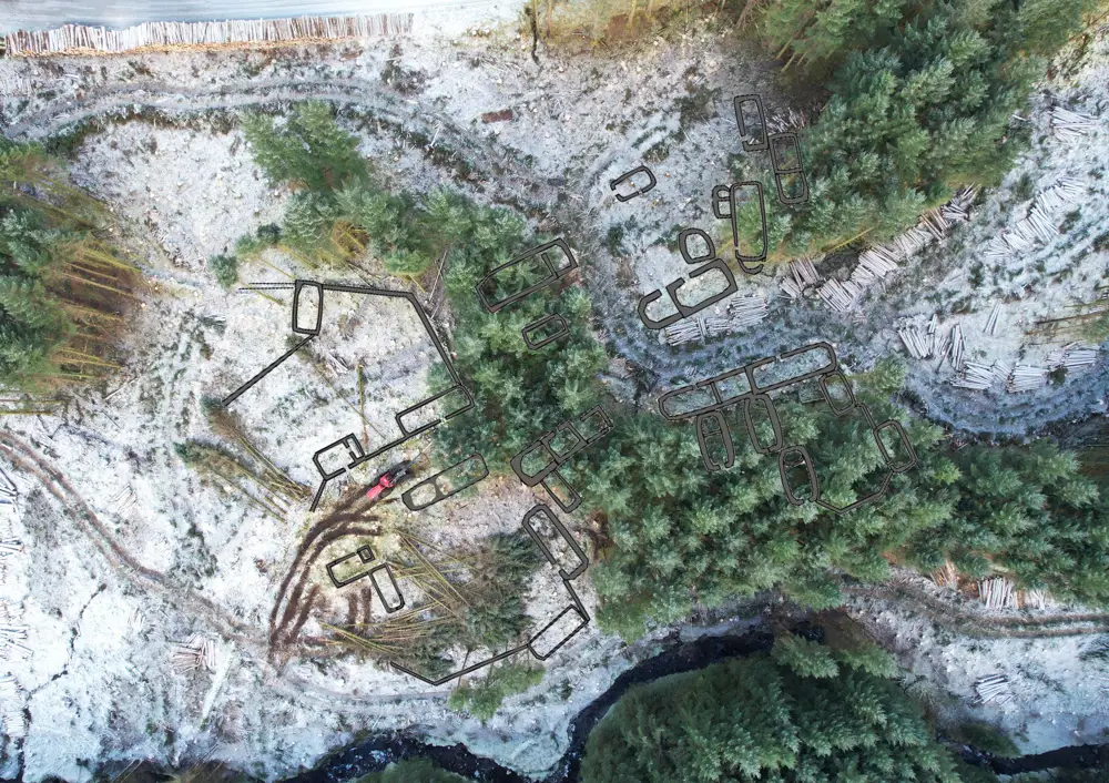
This vertical aerial view of the harvesting operation in and around the township has been annotated to show the location of the buildings. Some of the buildings are now readily visible in cleared areas, while some remain under trees. You can see how the harvester is operating between the buildings, using short tracks planned to best navigate around the township. The harvester positions itself to reach over the buildings to carefully fell trees away from their walls into open space, ready for processing into logs to be neatly stacked ready for removal by the forwarder. The forwarder is using the same tracks to bring the logs to the roadside, ready for loading onto timber lorries.