Kraiknish Dun
One of the most exciting things about investigating an archaeological site is being able to tell the story of the people who lived there. At Kraiknish Dun on the west coast of Skye, that story starts more than 2000 years ago.
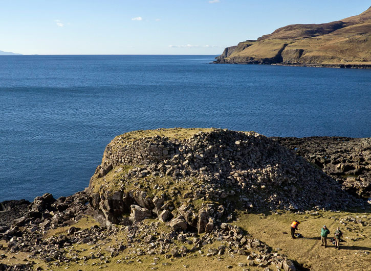
Sitting proudly on a coastal outcrop are the remains of a small stone fort. The huge drystone wall is more than three metres thick in places – a safe haven for an Iron Age family.
More recently, however, Kraiknish was a place of danger and despair. In the 18th century, the community was driven out by the Highland Clearances to make way for sheep. The thatch of the homes was set alight and stones pushed down. Today, only the outlines of a few buildings remain of the township, alongside the ‘lazy bed’ rig and furrow where they grew their crops.
Recording the past
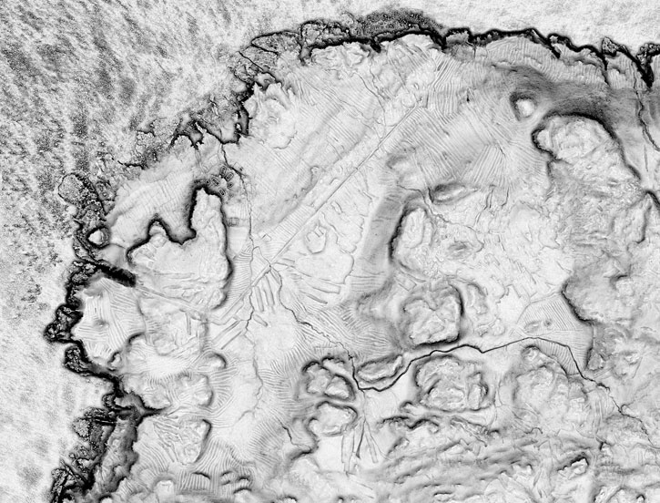
The purpose of surveying archaeological sites is to discover more about the past and help conservation management in the future. Although archaeologists have been surveying sites for decades, modern techniques have helped us see things in a new light.
At Kraiknish, state-of-the-art laser scanning and aerial photographs from a remote-controlled microcopter helped us build up a series of fantastic 3D images. The dun was surveyed by terrestrial laser scan survey (the white spheres in the photo below help the laser scanner create a ‘point cloud’ many millions of points in size).
The wider landscape was surveyed by high resolution aerial laser scanning. If you look carefully you can see the dun, the township and the lazy beds.
Get a new perspective of Kraiknish Dun with our animated fly-through of the point cloud: